File:Qu'Appelle Profile.png
From Crooked and Round Lakes Committee
Size of this preview: 800 × 526 pixels. Other resolution: 1,057 × 695 pixels.
Original file (1,057 × 695 pixels, file size: 94 KB, MIME type: image/png)
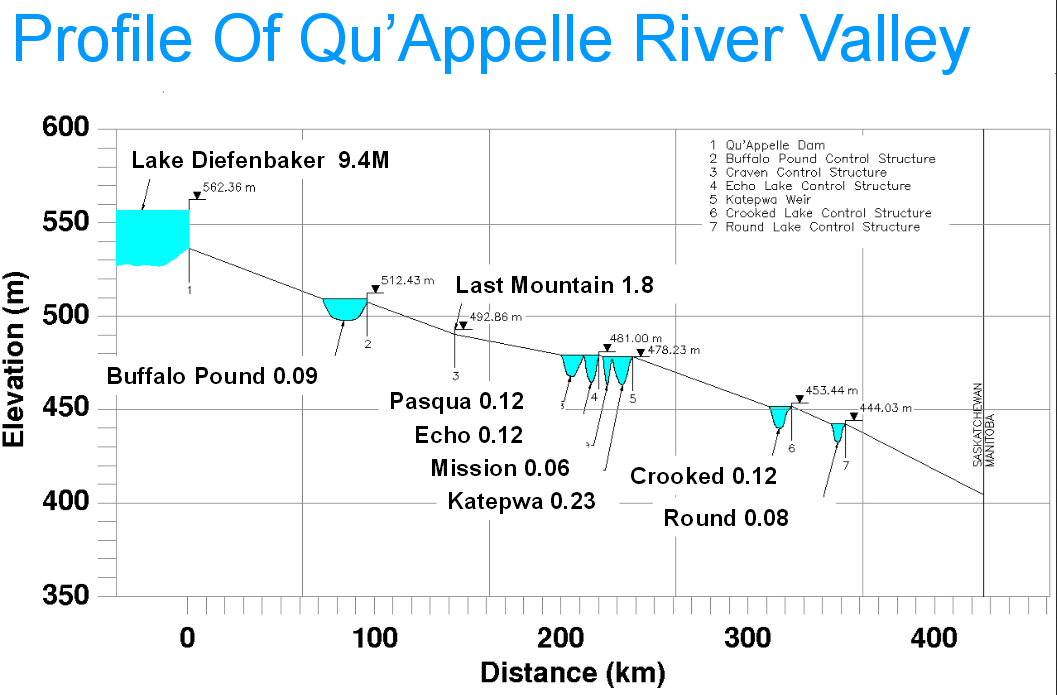
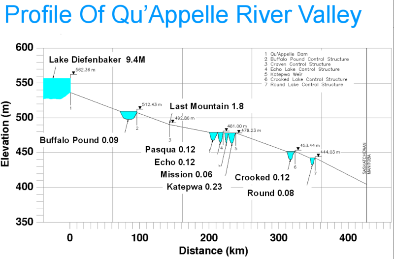
Elevation chart explaining which lakes flow into which others in the Qu'Appelle Valley chain.
File history
Click on a date/time to view the file as it appeared at that time.
| Date/Time | Thumbnail | Dimensions | User | Comment | |
|---|---|---|---|---|---|
| current | 13:59, 17 August 2015 | | 1,057 × 695 (94 KB) | Tyler (talk | contribs) | Elevation chart explaining which lakes flow into which others in the Qu'Appelle Valley chain. category:Water Security Agencycategory:Diagrams |
- You cannot overwrite this file.
File usage
There are no pages that link to this file.