Search results
Create the page "2014" on this wiki! See also the search results found.
Page title matches

File:2014 Aug 16 Agenda WSA Meeting.pdf [[Category:August 16 2014]][[Category:2014]][[Category:Agenda]] Agenda for the August 16th, 2014 meeting/presenation with the Water Security Agency.(179 KB) - 15:17, 28 August 2014File:2014 Aug 26 Agenda.pdf (450 KB) - 15:13, 28 August 2014File:2014 Aug 09 Minutes Aug 9.pdf ...y:2014 Flood]][[category:August 9, 2014 Meeting]]Minutes for the August 9, 2014 public meeting.(442 KB) - 16:30, 28 August 2014File:2014 Aug 14 Flood Committee Minutes.pdf ...]][[category:Flood Committee]][[category:2014 Flood]][[category:August 14, 2014 Meeting]](394 KB) - 16:32, 28 August 2014File:2014 August 16 Minutes Flood Committee WSA.pdf ...]][[category:Flood Committee]][[category:2014 Flood]][[category:August 16, 2014 Meeting]](406 KB) - 16:39, 28 August 2014File:2014 Aug 16 Minutes Flood Committee after WSA.pdf ...]][[category:Flood Committee]][[category:2014 Flood]][[category:August 16, 2014 Meeting]]The minutes for the continuing meeting after the WSA completed the(374 KB) - 16:39, 28 August 2014- All material dealing with the 2014 flood.10 members (1 subcategory, 9 files) - 16:23, 28 August 2014
-
1 member (0 subcategories, 1 file) - 16:40, 28 August 2014
-
1 member (0 subcategories, 1 file) - 16:40, 28 August 2014
-
2 members (0 subcategories, 2 files) - 16:40, 28 August 2014
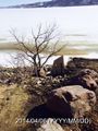
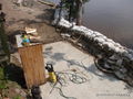
File:04-06-2014-03-09-PM.JPG [[category:April 24, 2014 Images]](480 × 640 (153 KB)) - 12:38, 2 September 2014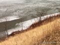
File:04-24-2014-10-21-AM-4.JPG [[category:April 24, 2014 Images]] Top of the Hill Close to Walters Property(1,296 × 968 (406 KB)) - 12:38, 2 September 2014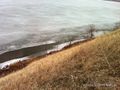
File:04-24-2014-10-24-AM-2.JPG [[category:April 24, 2014 Images]](1,296 × 968 (624 KB)) - 12:38, 2 September 2014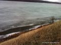
File:04-24-2014-10-24-AM.JPG [[category:April 24th, 2014]](1,296 × 968 (516 KB)) - 14:56, 2 September 2014- [[category:Image Galleries]] The height of the shoreline before the 2014 flood. At this point the lake was approximately 450m, or 1476ft, above sea12 members (0 subcategories, 12 files) - 14:12, 2 September 2014
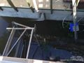
File:07-08-2014-02-24-PM-1.JPG |date=2014-07-08 14:24:09 [[Category:July 8, 2014 Images]](1,440 × 1,080 (392 KB)) - 14:59, 2 September 2014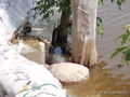
File:07-08-2014-02-24-PM.JPG ...Compare to the [[:Category:Crooked_Lake_Shoreline_April_2014_Images|April 2014 Gallery]] |date=2014-07-08 14:24:29(1,440 × 1,080 (448 KB)) - 15:00, 2 September 2014- ...1489ft above sea level, over 10 feet higher than its height on April 1st, 2014.2 members (0 subcategories, 2 files) - 15:01, 2 September 2014
File:07-02-2014-07-04-AM.jpg |date=2014-07-02 07:04:09 [[Category:July 2nd, 2014]](1,440 × 1,080 (367 KB)) - 13:09, 5 September 2014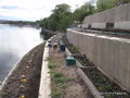
File:06-16-2014-05-49-PM.JPG |date=2014-06-16 17:49:10 [[Category:June 16th, 2014 Images]](1,440 × 1,080 (402 KB)) - 13:09, 5 September 2014


Page text matches
- ...1 Flood]], [[:category:2013 Flood|2013 Flood]], and [[:category:2014 Flood|2014 Flood]], [[:category:Kutawagan Lake|Kutawagan Lake Project]], documents com3 KB (450 words) - 13:53, 29 May 2017
File:2014 Aug 16 Agenda WSA Meeting.pdf [[Category:August 16 2014]][[Category:2014]][[Category:Agenda]] Agenda for the August 16th, 2014 meeting/presenation with the Water Security Agency.(179 KB) - 15:17, 28 August 2014File:2014 Aug 09 Minutes Aug 9.pdf ...y:2014 Flood]][[category:August 9, 2014 Meeting]]Minutes for the August 9, 2014 public meeting.(442 KB) - 16:30, 28 August 2014File:2014 Aug 14 Flood Committee Minutes.pdf ...]][[category:Flood Committee]][[category:2014 Flood]][[category:August 14, 2014 Meeting]](394 KB) - 16:32, 28 August 2014File:2014 August 16 Minutes Flood Committee WSA.pdf ...]][[category:Flood Committee]][[category:2014 Flood]][[category:August 16, 2014 Meeting]](406 KB) - 16:39, 28 August 2014File:2014 Aug 16 Minutes Flood Committee after WSA.pdf ...]][[category:Flood Committee]][[category:2014 Flood]][[category:August 16, 2014 Meeting]]The minutes for the continuing meeting after the WSA completed the(374 KB) - 16:39, 28 August 2014File:LakeWaterLevels.pdf ...ecurity Agency records of lake levels from early 1940's until present (mid-2014).(12.72 MB) - 16:20, 28 August 2014File:WSA Presentation Crooked Round Lake.pdf ...resentation on lake levels in Crooked and Round Lake and the causes of the 2014 flood.(3.46 MB) - 16:21, 28 August 2014- ...ves from the WSA met the Flood Committee in a closed meeting on August 16, 2014.11 members (1 subcategory, 10 files) - 15:58, 28 August 2014
- All material dealing with the 2014 flood.10 members (1 subcategory, 9 files) - 16:23, 28 August 2014
File:04-06-2014-03-09-PM.JPG [[category:April 24, 2014 Images]](480 × 640 (153 KB)) - 12:38, 2 September 2014File:04-24-2014-10-21-AM-4.JPG [[category:April 24, 2014 Images]] Top of the Hill Close to Walters Property(1,296 × 968 (406 KB)) - 12:38, 2 September 2014File:04-24-2014-10-24-AM-2.JPG [[category:April 24, 2014 Images]](1,296 × 968 (624 KB)) - 12:38, 2 September 2014File:04-24-2014-10-24-AM.JPG [[category:April 24th, 2014]](1,296 × 968 (516 KB)) - 14:56, 2 September 2014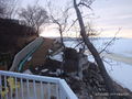
File:Crooked Lake Shoreline.JPG |date=2014-04-07 06:54:04 [[Category:Crooked Lake Shoreline April 2014 Images]](1,440 × 1,080 (390 KB)) - 13:35, 2 September 2014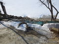
File:Crooked Lake Shoreline 2.JPG |date=2014-04-01 09:05:36 [[Category:Crooked Lake Shoreline April 2014 Images]](1,440 × 1,080 (516 KB)) - 13:35, 2 September 2014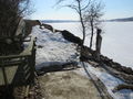
File:Crooked Lake Shoreline 3.JPG |date=2014-04-01 09:05:39 [[Category:Crooked Lake Shoreline April 2014 Images]](1,440 × 1,080 (528 KB)) - 13:35, 2 September 2014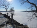
File:Crooked Lake Shoreline 4.JPG |date=2014-04-01 09:05:43 [[Category:Crooked Lake Shoreline April 2014 Images]](1,440 × 1,080 (523 KB)) - 13:35, 2 September 2014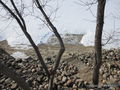
File:Crooked Lake Shoreline 5.JPG |date=2014-04-01 09:05:48 [[Category:Crooked Lake Shoreline April 2014 Images]](1,440 × 1,080 (638 KB)) - 13:36, 2 September 2014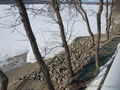
File:Crooked Lake Shoreline 6.JPG |date=2014-04-01 09:05:51 [[Category:Crooked Lake Shoreline April 2014 Images]](1,440 × 1,080 (643 KB)) - 13:36, 2 September 2014


